![]() Seacombe Lodge, King’s Road, Clapham Park
Seacombe Lodge, King’s Road, Clapham Park
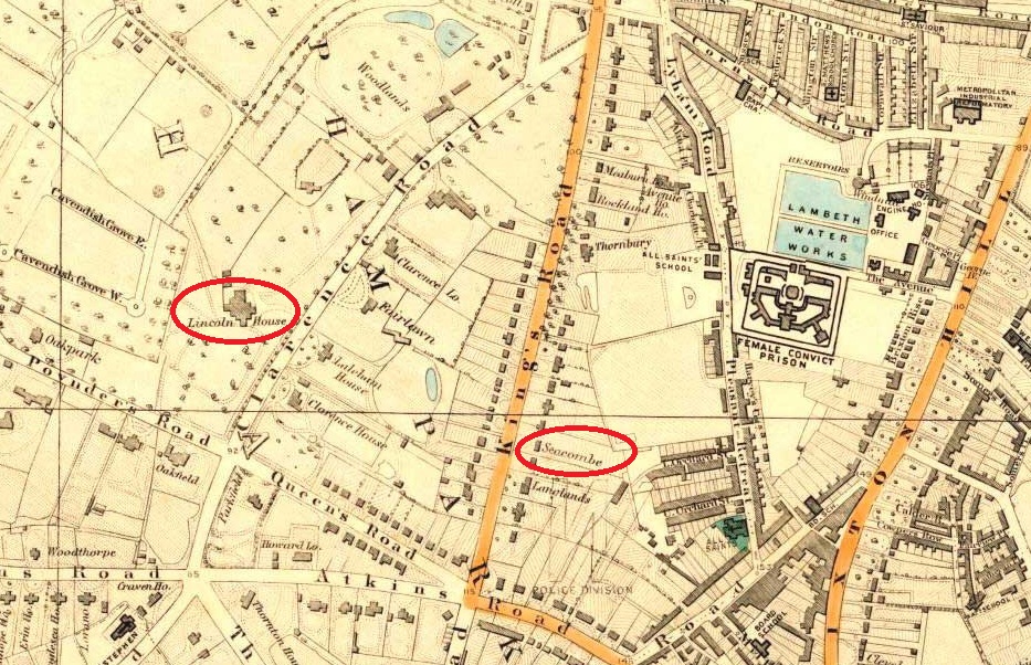
Extract of a map of Clapham Common, Clapham Park and Brixton Hill, Lambeth, 1877
(from the website
Ideal Homes: A History of South-East London Suburbs  ).
).
From about 1832 to 1850 Lincoln House was the home of Thomas Cubitt, the developer of the Clapham Park housing subdivision. Lincoln House was demolished in 1905 and replaced by Rodenhurst Road and the houses on the west side of Clarence Avenue.
A number of photographs of the Clapham Park Victorian mansions on King’s
Road (renamed to King’s Avenue), before demolition after the Second World
War, are at the Lambeth Landmark website. For example, houses on the
west side of the road were:
No 86 King’s Avenue,
(back view),
No 88 King’s Avenue,
No 96 King’s Avenue,
No 104 King’s Avenue, and
No 106-108 King’s Avenue.
Houses on the east side of the road included Seacombe Lodge, 131 King’s Avenue, and:
No 127 King’s Avenue, and
No 133-135 King’s Avenue.